David E. King Field Work Award
The David E. King Field Work Award is given annually to one or more full-time graduate students in the Department of Geosciences to support their research. Preference is given to projects that require support for field work. This Award was made possible by a generous gift from former graduate student Mr. David E. King (MS '84). In creating this Award, Mr. King noted that external funding had made it possible for him to conduct field work for his dissertation research. This Award provides a similar benefit for current graduate students.
Applications are available in March with a submission deadline in April. Recipient announced at department convocation in May.
Past Recipients of the David E. King Field Work Award:
 |
2025Kevin Hatton
|
 |
2025Victoria Castle |
 |
2024Roheyatou CeesayLuminescence Sampling Report in Chari member Koobi Fora formation, Kenya
|
 |
2024Kirtee Ramo |
 |
2023Thomas ReillyQuantifying Bedload Transport of the Turkwel River Using a Nodal Seismic Array |
 |
2022Kevin HattonThe Prescott Paleochannel as a key test for Miocene drainage reversal in the Arizona Transition Zone |
 |
2022Taylor Grandfield |
 |
2021Kevin HattonConstraining Drainage Reversal of the Mogollon Highlands Collapse |
 |
2021Reed Hopkins
|
 |
2020Yang Gao |
 |
2020Mae SaslawCalibration of Paleosol Carbonte Clumped Isotope Paleothermometry in the Turkana Basin |
 |
2019Mae SaslawFoundational research on modern and paleo isotope hydrology of the Turkana Basin
|
 |
2018
|
 |
2018
|
 |
2017
|
 |
2017
Scouting Terrestrial Analogue Sites to Guide Planetary Remote Sensing Research |
 |
2015
|
 |
2014
|
 |
2013
Isotope Systematics of Shocked Feldspar: Implications for Planetary Chronology |
 |
2012
|
 |
2012
Investigating fabrics in peridotite outcrops of the Western Gneiss Region in Norway
|
 |
2011
Submarine Groundwater Discharge on Long Island's North Shore |
 |
2010
|
 |
2010
187Re-187Os Dating of Black Shales from Late Pennsylvanian Cyclothems, Kansas |
 |
2009
The Assessment of a Solar Disinfection Method for Water in the Kondoa Region, Tanzania |
 |
2008
The Origin of the Calverton Ponds, Long Island
|
*******************************************************************************************************
Fingerprinting Sullivan Butte-Type Latite Containing Arclogite Xenoliths Within the Prescott Paleochannel - Kevin Hatton (Faculty Advisor - William Holt)
Fingerprinting garnet pyroxenite xenoliths (arclogites) at BT Butte is necessary to expand on the range of their related eruptions and further test the origin of these xenoliths. Latite intrusions, with similar xenoliths dated to 25Ma, have been extensively documented in the Sullivan Buttes and Camp Creek areas, approximately 35 and 130 km east and southeast of the BT Butte region, respectively. The timing is consistent with these latite melt bearing xenoliths having been derived from the removal of the Mojave lower crust and upper mantle during Laramide flat slab subduction. These observations show that flat oceanic plateau subduction resulted in the bulldozing of this arclogite material to a termination zone at the base of the lithosphere below the Arizona Transition Zone (ATZ) (Chapman et al., 2020; Kapp et al., 2023), which led to the creation of high topography in the ATZ region. Kapp et al. (2023) argue that the eruptions of the latites, containing the bulldozed Mojave arclogite xenoliths occurred during the key time interval of slab rollback, ignimbrite flareup, arclogite delamination, which was quickly followed by extensional collapse of the Mogollon Highlands and a drainage reversal. This discovery places this project within a significant and interesting geodynamic context: the timing of these eruptions should correspond with the initiation of extensional collapse that leads to drainage reversal. These funds supported a field-based study of BT Butte and the Prescott Paleochannel, which enabled sample collection of xenoliths for petrography, bulk and isotope geochemistry and zircon U-Pb dating in the FIRST lab at Stony Brook University.
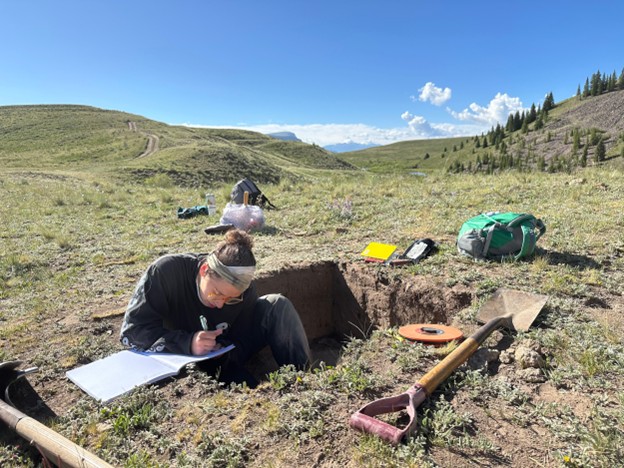
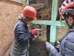
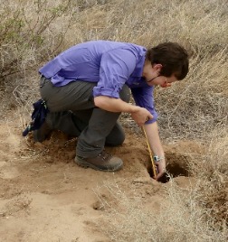
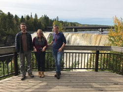
Applying Luminescence Techniques to Folsom Occupation and Environmental Change at Black Mountain, Colorado - Victoria Castle (Faculty Advisor - Marine Frouin)
The Black Mountain site in Colorado is one of North America’s rare high-elevation Folsom period sites, offering insights into early human settlement during the waning stages of the last Ice Age. Unique fluted projectile points and stratified cultural deposits indicate repeated occupations; however, the site lacks a reliable chronology. This project applies Optically Stimulated Luminescence (OSL) dating to directly determine the burial ages of archaeological sediments and nearby glacial moraines, linking human presence with local ice retreat. The David King award supported fieldwork conducted in June 2025, where new sediment samples were collected and documented. These samples will be processed at Stony Brook University using quartz OSL protocols. By establishing a timeline for both occupation and environmental change, this research aims to clarify how Paleoindians adapted to shifting high-altitude landscapes while demonstrating the broader application of luminescence dating to both archaeological and geological contexts.
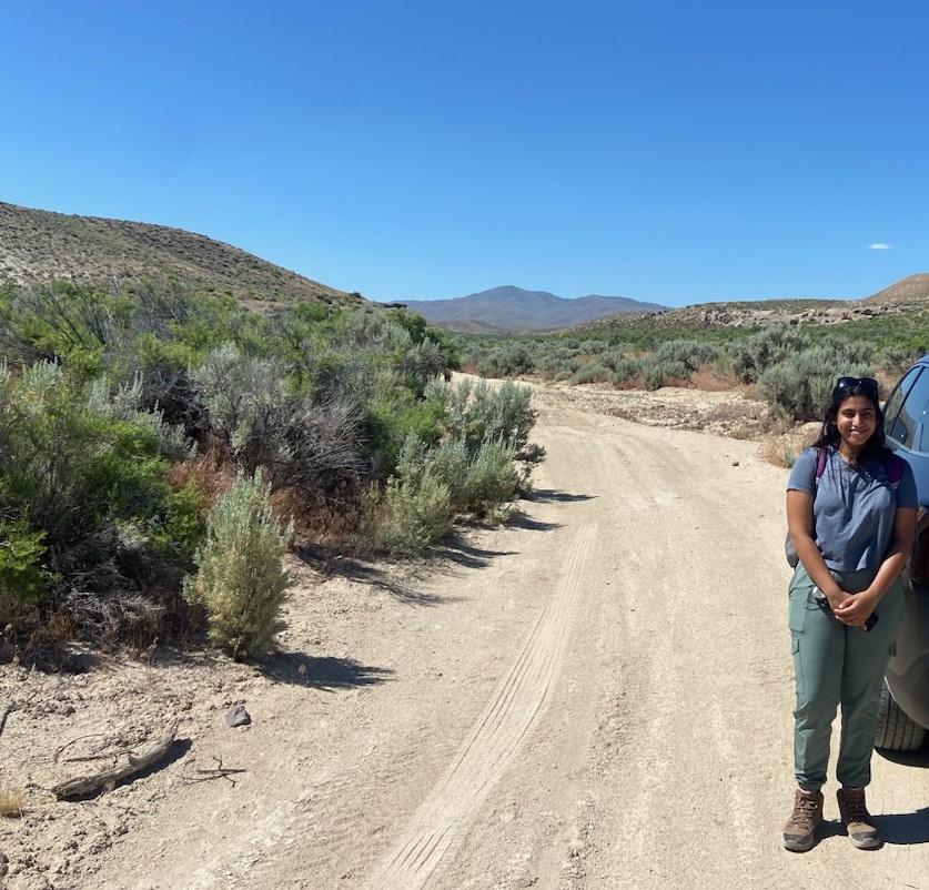
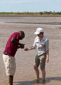
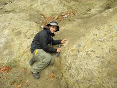
Luminescence Sampling Report in Chari member Koobi Fora Formation, Kenya - Roheyatou Ceesay (Faculty Advisor - Marine Frouin)
The Turkana Basin in East Africa is famous for its rich hominin fossils and artifacts, crucial for our understanding of human evolution. The Koobi Fora Formation on Lake Turkana's east side is a 560-meter thick area with well-dated volcanic layers. The Chari member, its most recent section, has Upper and Lower units separated by a 700,000-year gap known as the Upper Chari Onlap unconformity. Our project uses luminescence dating to address these chronological gaps, revealing when minerals were last exposed to sunlight. Fieldwork was conducted in Areas 4 and 7 near Ileret. Area 7 has unique Kale tuff outcrops, while Area 4 includes both Chari units. This research is integral to my doctoral studies, focusing on refining luminescence techniques for very young and very old samples.
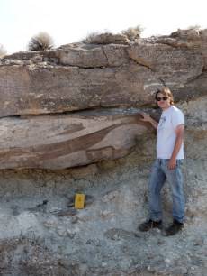
The Shoofly Oolite Member of the Glenns Ferry Formation, Idaho, as an analogue to sedimentary rocks in Jezero Crater, Mars - Kirtee Ramo (Faculty Advisor - Joel Hurowitz)
The Mars 2020 rover, Perseverance is currently investigating Jezero a 45 km-wide impact crater in the Nili Fossae region of Mars which has been inferred to be a paleolake (~3.5 Ga) due to the presence of fluvio-deltaic sedimentary strata. The goal of this mission is to characterize the crater’s geologic history, search for signs of life in an ancient habitable environment and collect samples for Mars Sample Return (MSR). Strong orbital signatures from Jezero’s delta and “Margin Unit” indicate that they are the most well-exposed carbonate-rich lithologies on Mars and hold key records for understanding the paleoclimate and geochemistry of a potential lacustrine lake. Since the “Margin Unit” carbonates are present through a narrow range of elevation, they could have been deposited as part of a sedimentary shoreline but other hypotheses such as pyroclastic deposits and altered igneous cumulates have also been proposed.
These carbonate orbital detections were confirmed by fine-scale analysis of outcrops by the Planetary Instrument for X-ray Lithochemistry (PIXL). Its measurement show that carbonates are present as coatings around mm-size grains along with potential diagenetic phosphate phases. To investigate a sedimentary origin for these carbonates, we’re examining a potential Earth analog: the Shoofly Oolite Member of the Glenns Ferry Formation in southern Idaho, a late Tertiary lacustrine deposit containing calcium carbonate ooids and secondary phosphates. The David E. King Field work award was used for a field trip to Idaho June 2024. Eleven samples were collected from the transgressive and progradational units along with the phosphorite horizons which were then analyzed on a laboratory prototype of the PIXL instrument to compare geochemical and textural properties with the Martian datasets. This work aims to evaluate a sedimentary origin for the carbonates in Jezero Crater along with ground truthing carbonate identification with PIXL.
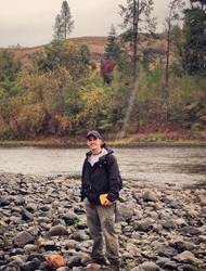
Quantifying Bedload Transport of the Turkwel River Using a Nodal Seismic Array - Thomas Reilly (Faculty Advisor - Weisen Shen)
Traditionally seismologists have analyzed seismic data with the mindset that there are two components to the data in front of them: signal and noise. The “Signal” here being the less than one percent of the seismic record containing useful P and S waves from Earthquakes, with the “Noise” being everything else. However, over the past twenty years we’ve begun to think of the seismic record not as Earthquake Signal with everything else being noise, but of a data set with multiple different signals, including human activity, wind, ocean phenomena and earthquakes. In this study we hope to utilize the noise in two distinct ways. Firstly, we will use seismic noise and traditional techniques to create models of the crust and upper mantle. This will better help us understand the structure and possibly composition of the area and give us insight into the nature of the East African Rift section which comprises the Turkana Basin. Secondly, we wish to constrain bed load transport along a section of the Turkwel river. As the river flows and takes sand, gravel, etc. with it downstream, the interactions between these particles give off a signal that we can detect.
We deployed 70 seismic sensors over 140 km transect to accomplish our main transect. Of these 70, 66 were recovered successfully with an average of 27 days of data. For measuring the river bedload, we placed ten sensors in pairs along a 50 km stretch of the Turkwel River. One close to the river and one further away. Of these ten, seven of these sensors were successfully collected, with two more found recently having been removed by locals and then tracked down by our guide and TBI staff member, Francis Ekai. These recovered sensors have given us terabytes of seismic record that we have already begun to dive into and work towards our two goals.
The Prescott Paleochannel as a key test for Miocene drainage reversal in the Arizona Transition Zone - Kevin Hatton (Faculty Advisor - William Holt)
The Prescott Paleochannel is an 8 km wide channel in West-Central Arizona consisting of a multi-clast conglomerate that contains Paleozoic and Early Proterozoic cobbles and boulders that were derived from the uplifted Mogollon Highlands to the SW of the present-day channel locality. Imbricate clasts within the deposits reflect SW paleocurrent directions and suggest that this channel is part of a key drainage reversal that occurred after the Mogollon Highlands experienced extensional collapse in the Oligocene. Sediment provenance studies of the Sespe Formation within the Los Angeles Basin region suggest sediment sources within regions as far east-northeast as the present-day Arizona Transition Zone. Coupled climate and 4-D thermomechanical lithosphere modeling performed to date indicate that the timing of uplift and tilt of the Colorado Plateau (CP) have a significant influence on the source and volume of sediments supplied to the Sespe Delta region. The Prescott Paleochannel is in an ideal location to test competing uplift models.
While we were unable to make it to the lowermost section of the Paleochannel, we did make it to two localities along the rough roads in the Prescott National Forest. The geologic mapping of the area is very well done generally, but we were able to investigate some discrepancies. The first was at BT Butte which was originally mapped as a basalt mesa. We spent four days collecting volcanics, producing a geologic map and discerned it was a volcanic neck of intermediate composition crosscutting the paleochannel gravels. We pressed onward to the Eastern side of Sheridan Mountain and the road became too hazardous to continue. So we investigated nearby outcrops, “The Amphitheater” and “The Nosebleeds”, and discerned that the originally mapped paleochannel sediments are sequences of lahar or debris type flows. Two ashes were collected from the section along with basalt at the base and a stratigraphic column was made. Further investigation will lead to the relationship between Sheridan Mountains sediments and the Paleochannel.
Sediments as an Archive of Time, Environment, and Human Presence: a Micro-Regional
Study of the Pleistocene-Holocene Transition in Southern Poland - Taylor Grandfield (Faculty advisor - Marine Frouin)
The Udorka Valley, located in southern Poland, provides a unique opportunity to study
the relationship between human groups and their use of natural resources in three
time periods; towards the end of the Paleolithic, throughout the Mesolithic, and during
the Neolithic revolution. Archaeological excavations at the sites of Perspektywiczna
Cave and Poręba Dzierżna, located within a 2 km radius, suggest that these sites were
occupied over several thousand years. Human activity at these sites was specialized
and different, possibly by similar human groups sharing the same territory. I aim
to apply cutting-edge luminescence dating techniques at these two sites and better
understand human adaption through a changing environment.
The prestigious David E. King Field Work Award allowed me to join the team of archaeologists, geologists, and ancient DNA experts at Perspektywiczna Cave and Poręba Dzierżna site this summer 2022. I collected 25 sediment samples for luminescence dating purposes. In the laboratory, measurements will be made on quartz and feldspar at the finest scale possible: the sand-sized grain. Only at this scale can we obtain necessary information regarding light exposure histories or site formation processes and identify partial bleaching or mixing of grain populations with different depositional ages. The result of this study will allow me to replace the archaeological and environmental records on a time scale. In addition, this refined chronological framework will reveal the challenges faced by the last hunter-gatherer groups and first farmers and their response to the rapid and intense environmental changes during the Holocene.
Constraining Drainage Reversal of the Mogollon Highlands Collapse Across the Transition Zone of Arizona - Kevin Hatton (Faculty Advisor - Troy Rasbury)
The Mogollon Highlands are thought to have been a prominent northwest-southeast trending mountain belt or plateau some 36 million years ago. Debates rage about the timing of uplift of the Colorado Plateau and consequent downcutting of the Colorado River to create the Grand Canyon, but undeniably there was a high belt to the south of the Colorado Plateau when these gravels were deposited. If the Colorado Plateau was high in the Cretaceous as some studies indicate, the Mogollon Highlands were even higher. Where the Mogollon Highlands stood is now the site of middle crustal exhumation in core complexes. The ‘Transition Zone’ between the Colorado Plateau and this extremely extended core complex region records a fragmentary record of the collapse of this mountain belt.
We proposed that there are many more eruption events than have been recognized and that correlation of these ashes have been based on some old assumptions. Our field work was to sample tuffs, basalts, and carbonates from across the Transition Zone of Arizona in the context of sedimentary strata and drainage directions to provide an improved timing of the collapse of the Mogollon Highlands and, more especially, the timing of drainage reversal. This timing can then be compared to geodynamic models that synthesize the surface geological observations and predict how the lithosphere changed to accommodate boundary forces as the Farallon Plate tore off and descended into the mantle- accounting for the very tuffs we are using to constrain the timing of orogenic collapse and drainage reversal.
Our team consisted of Kevin Hatton, William Holt, Troy Rasbury, Katie Wooton and the paleoriver and regional expert Andre Potochnik.
Testing the Mass Balance Method Used for Determining the Amorphous Component Composition in Gale Crater, Mars, on Volcanic Sediments from Kilbourne Hole - Reed Hopkins (Faculty Advisor - Deanne Rogers)
The field work Reed completed during November 2021 at Kilbourne Hole was part of the field activities of the Remote, In Situ and Synchrotron Studies for Science and Exploration-2 (RISE2) sub-node of the NASA Solar System Exploration Research Virtual Institute (SSERVI). Kilbourne Hole is Pleistocene-aged maar volcanic crater located in the Potrillo volcanic field in southern New Mexico. It hosts rhyolitic ash fall deposits, base surge deposits, paleosols, basaltic lava flows and abundant mantle/crustal xenoliths. This site has been used previously as a terrestrial analog site to test field equipment for planetary surface exploration.
From data collected by MSL Curiosity in Gale crater, Mars, the composition of the crystalline component of a material is subtracted from the bulk sample composition, and the difference is assigned to the amorphous component. In this process, the bulk chemical composition is measured from the surface of a rock or sediment, so one major assumption is that the surface of the material represents the bulk material, and there are no coatings on the grain surfaces. By performing equivalent mass-balance calculations on terrestrial sediments from Kilbourne Hole that are both ground and unground, we will be able to test any effect of grain coatings on the bulk composition measurement, and therefore the amorphous composition estimate.
Reed successfully collected rock and sediment samples from several locations in the Potrillo volcanic field. The analysis of these samples has just started, but with these samples, we hope to test the mass balance calculations used to determine the amorphous composition in sediments from Gale crater. This study will help us to better interpret new and old mineralogical data received from MSL Curiosity.
Fieldwork to Improve Isotope Paleoclimatology and Paleobiology of Ammonites from Late Cretaceous Methane Seeps in Western Interior Seaway - Yang Gao (Faculty Advisor - Greg Henkes)
Ammonoidea was a common and widely distributed group in Earth’s ocean before and
throughout the Cretaceous period. However, because they are now extinct. Their paleoecology
and habitat have to be inferred from fossils. Well-preserved ammonite shells have
been analyzed and studied for paleoenvironment reconstruction, which has helped constrain
their depositional environment, biology and habitat but these efforts are complicated
by diagenesis and underdetermined isotope proxies. In North America Late Cretaceous
ammonite fossils are
abundant at so-called ‘Tepee Buttes’, fossiliferous authigenic carbonate mounds formed
around ancient methane seeps and preserved within the Pierre Shale Formation of the
Western Interior Seaway (WIS).
To better characterize the paleotemperature and paleoenvironment of WIS seeps and to investigate the nature of seep-associated ammonites, we have designed a multifaceted study. First, in 2017-2018 we applied clumped isotope paleothermometry to high-magnesium, methane-derived authigenic carbonates (MDAC) collected from 5 seep localities within the upper Campanian Pierre Shale Formation in South Dakota. We measured and derived average clumped isotope temperatures for WIS bottom water to be 23 °C while WIS water δ 18 O are -0.5 ‰. Then we moved to fossil Ammonites, however, after applying clumped isotope analysis to well preserved Ammonites, we discovered an unexplainable clumped isotope disequilibrium in these fossils. Therefore, the purpose of this field work is to collect more Ammonites from the AMNH localities, where I conducted my master thesis work, therefore we can compare the temperature derived from Ammonite with temperature derived from methane seep micritic carbonates. The original field work was scheduled for 11-12 days in Summer 2020, but this plan was significantly impacted by COVID-19 and was put on hold till Summer 2022, The original, almost 2 weeks of field work was short cut to 4 days in South Dakota only. But even though it was cut short, with the help of my collaborators form AMNH and Brooklyn College, I was still be able to collect two boxes of Ammonite samples along with some seep sediments. All of these will be analyzed for clumped isotope in the future and will be a part of my PhD dissertation.
David E. King Field Work Award Project Report: Monitoring soil conditions in the Turkana Basin - Mae Saslaw (Faculty Advisor - Gregory Henkes)
The Turkana Basin is known for sites that contain some of the earliest hominin fossils, and ancestors of most modern African megafauna. Additions to the modern climate data set for the Turkana Basin will be used in refining models of soil water evaporation, which have applications for paleoclimate analysis in a region known for its fossil localities. My project seeks to understand the climatic conditions in Turkana in the Miocene, using clumped isotopes of paleosol carbonates. Analysis of Miocene carbonate samples provides estimates of soil temperature, and soil water oxygen isotope ratios (δ18Ο), which are a function of both the source water isotope ratios and the extent of evaporation in the soil. Models from modern soil data will show relationships between source water and soil water isotope ratios with depth, however, collecting soil waters from desert sediment is challenging.
Establishing ongoing collection of soil water in Turkana requires installation of soil rhizons, which allow for the sampling of water from soil pore space. Using funds from the David E. King Field Work Award, I was able to deploy soil rhizons along with soil temperature probes at monitoring sites on the two campuses of the Turkana Basin Institute (TBI). Local collaborators at TBI, including graduate students from Turkana University College, were trained in the soil water collection procedure, which is to take place following heavy precipitation. Each monitoring site contains rhizons installed at depths of 50cm, 30cm, and 10cm, and each collection requires fitted syringes and storage vials. Our goal is to compare soil water from these three depths to precipitation that is also being collected and measured at these sites. In addition, soil temperature probes that successfully recorded over one year of data at TBI research centers were re-deployed, and we continue to build on this valuable modern data set. Depth profiles of soil water δ18Ο and temperature will provide a model for understanding evaporation under conditions similar to past climates in Turkana. Along with soil profile data, collection and analysis of surface waters from Lake Turkana and its tributaries will improve models of modern isotope hydrology. The samples collected this field season, and those that will be collected and retrieved from the new monitoring sites, are important contributions to modern climate research in Turkana, and paleoclimate reconstructions using soil carbonates.
Foundational research on modern and paleo isotope hydrology of the Turkana Basin - Mae Saslaw (Faculty Advisor - Gregory Henkes)
Records of modern and ancient soil temperature provide ecological context and indicate changes in climate over time. Understanding the climate history and contemporary conditions in the Turkana Basin in northern Kenya is important for research in hominin evolution, human origins, and resource management for people who inhabit the region today. Funding provided by the David E. King Field Work Award enabled me to establish a soil temperature monitoring program at the Turkana Basin Institute (TBI) Ileret Research Center, and continue collection of surface water and precipitation for oxygen isotope (δ18O) analysis. The data obtained from long term temperature monitoring and from ongoing water collection are central to my long term projects in understanding climate interactions in the Turkana Basin.
With the help of TBI staff, eleven temperature loggers were buried at three sites near the Ileret Research Center laboratory. For approximately one year, these sensors will record temperature every thirty minutes. The results — temperatures at four depths, under three different sun exposure conditions — will be a valuable new data set for the community. Soil temperature records are applicable to both paleoclimate and contemporary climate research in the region; paleothermometry data from soil carbonates can be compared and calibrated to modern temperature profiles, and continual deployment of the sensors in Turkana will further contribute to broader climate monitoring efforts.
Waters from Lake Turkana and from precipitation were collected for δ18O analysis, and materials for future water collection provided to local collaborators. Values of δ18O in water are used to constrain water source and evaporation. More water isotope data is needed to better understand the combined effects of tectonic and atmospheric conditions on precipitation and surface water availability. Analysis on samples collected in 2019 is currently underway and will contribute to our current isoscape records.
The paleoenvironment of Late Cretaceous methane seeps in Western Interior Seaway:
A new perspective from carbonate clumped isotope thermometry - Yang Gao (Faculty Advisor
- Gregory Henkes)
The so-called “Tepee Buttes” are fossiliferous authigenic carbonate mounds formed around ancient methane seeps preserved within the Pierre Shale Formation of Western Interior Seaway (WIS) during the Late Cretaceous. Previous research had reported extreme depletion of δ13C in carbonate cements and Ammonite shell fossils at several different locations within the Tepee zone. Such negative δ13C values in carbonate cements and shells may indicate a high temperature methane-derived carbon source is present during the formation of those carbonates and seep-inhabiting Ammonites. This implies that dissolved inorganic carbon (DIC) generated by anaerobic oxidation of methane, along with ambient seawater DIC, act as significant carbon sources for shell growth in these seep environments. My interest is applying carbonate clumped isotope thermometry to well-preserved authigenic carbonate samples and fossils of Ammonites (Baculites) to better understand the paleoenvironment and paleobiology of the WIS methane seeps.
In order to collect suitable samples for my study, I worked in the field along with the AMNH 2018 paleontology expedition team in South Dakota and eastern Montana. In our team, researchers from five different institutes worked collaboratively to collect well-preserved Ammonite shell fossils and rock samples for paleontological and geochemical studies. We stopped at AMNH excavation sites in Red Shirt, Wall, Hill City, Rapid City in South Dakota, and Glendive in Montana to research different morphologies and fossil types of the region. Most of the sites are very fossiliferous and are in B Compressus zone. After ten days of intense excavation and collection, we accumulated over 30 boxes of usable shell fossils, rock, and sediment samples, which will be stored in the museum and become a valuable resource for collaborating research groups around the country.
Observation of microbial life in modern and Precambrian formations on the Western Australian coast & implications in the search for extraterrestrial life - Ella Holme (Faculty Advisor - Joel Hurowitz)
Understanding the conditions in which microbial life developed on the early Earth is an important step in determining the potential pathways for life to develop on other planetary bodies. Investigating Precambrian rock formations, which are host to some of the oldest traces of life on Earth, can provide crucial insight into the environment and fluid chemistry of the earliest fluid bodies and the microbes they were able to sustain; it is also important to illustrate the evolution of fluid chemistry over geologic time in order to characterize the conditions which allow sustained habitability on long timescales. Several excellent examples of Precambrian formations can be found in Western Australia, including the stromatolite-bearing Fortescue Group and the Dresser Formation, the latter of which houses a newly-discovered geyserite that is the oldest potential evidence of terrestrial life. The coast of Western Australia is also host to the living stromatolites of Shark Bay, which can help to provide context for the formation of stromatolites in ancient rock and create further constraints on the evolution of microbial life from the Precambrian to the modern Earth. Thus, a traverse through the formations of Western Australia has the potential to better inform the astrobiological community on the processes in which habitable environments can be created and maintained through geologic time.
The 2018 Astrobiology Grand Tour, hosted by the Australian Center for Astrobiology at the University of New South Wales, spans approximately 1,700 km of the Western Australian coast, starting with the living stromatolites of Shark Bay and ending in the Pilbara Craton. Other sites of interest include the 1.8 Ga Duck Creek Dolomite, the 2.4 Ga Turee Creek Group, and 2.5 Ga banded iron formation (BIF). This backward hike through Australia’s geologic history will illustrate how depositional environments changed through the Precambrian and the effect of those changes on early life. The focus of this field campaign was providing context for my primary research project, which is concerned with the evolution of Fe-rich water bodies in the Precambrian using the Gunflint Iron Formation. Observing fossil-bearing rocks from a similar time period and deposited from a similar water body is extremely important for interpretation of my own samples and for painting a broader picture of Precambrian ocean chemistry.
Constraining the habitability of iron-rich water bodies on early Mars using Paleoproterozoic siderites from the Gunflint Iron Formation - Ella Holme (Faculty Advisor - Joel Hurowitz)
This study is aligned with Goal 4 of the NASA Astrobiology Roadmap, which seeks to understand the evolution and persistence of life on Earth, paying specific attention to the response of life to environmental change on a planetary scale. Iron formations such as the Gunflint are associated with oscillation of O2 concentration in seawater, and the effect of these fluctuations on pH in Paleoproterozoic seawater could have had important implications for microbial life in aquatic environments on early Earth. The Gunflint Iron Formation is an example of a banded iron formation, characterized by chert-iron mineral laminations deposited during alternating periods of anoxia and oxygenation in seawater. Its depositional age is 1.88 Ga, as determined by U-Pb dating of zircons from ash beds deposited within the Gunflint. It is well exposed in the Kakabeka Falls region outside of Thunder Bay, Ontario, where our field work was conducted. With the successful completion of the field work, the focus of my work is now on sample characterization and preparation for isotopic analyses. Samples have been and continue to be prepared for petrographic and spectroscopic analysis using thin section equipment available in the SBU Geosciences Sedimentary Petrography Lab. This task is being undertaken with the help of undergraduate student Natalie Crnosija. Thin sections are ground to standard thickness (~30 microns) and are then polished sequentially using Al2O3 grit in grain sizes 15µm, 5µm, 3µm, and 1µm in order to ensure uniform smoothness of the section for Raman analysis. Preliminary results from Raman confirm that siderite is the most abundant carbonate phase, with ankerite appearing as a product of early diagenesis. LA-ICP-MS measurements continue to be collected from a suite of collected samples; primary focus has been on boron concentration and its correlation to major elements Ca, Fe, and Mg, as well as with other trace elements such as Sr and Ce. Initial results indicate that B is generally positively correlated with Fe, indicating that either siderite is a primary carbonate phase that has not experienced diagenetic B loss or that siderite incorporates B very strongly into its mineral.
Scouting terrestrial analogue sites to guide planetary remote sensing research - Justin Cowart (Faculty Advisor - A. Deanne Rogers)
Our knowledge of Mars and the Moon depends heavily on interpretation of remote data
sets, acquired by satellites and rovers. Making sense of these data sets often requires
comparison with terrestrial locations that exemplify the processes that we observe
on the surfaces of those bodies. Funding by the David E. King Award made it possible
for three graduate students and an undergraduate to travel with me to several world-class
locations in Utah to study planetary analog geological landforms.
The first site explored was inverted channel features near Green River, Utah. These
features represent sandstones deposited some 115 million years ago on the floor of
a meandering river. The more erosionally-resistant channel sandstones now form narrow,
winding ridges that stand above the surrounding shale plains. Similar deposits have
been spotted in multiple places locations on Mars, and interpreting them is important
for understanding the history of water on the Red Planet’s surface. Walking the outcrop
allowed us to correlate large-scale morphologies that are visible from orbit to lithologic
boundaries within the inverted channel feature. We also collected samples that will
let us study the thermophysical properties of the rocks within these deposits, which
will allow us to better identify and characterize Martian inverted channels using
the THEMIS instrument onboard the Mars Odyssey orbiter.
We then visited the Upheaval Dome structure in Canyonlands National Park, a heavily eroded example of a complex crater. The deep erosion experienced by this crater allows us to study the processes that occur deep underneath the impact that are generally out of reach in better preserved craters. Complex craters are a common landform on the Moon and Mars, but no landed mission has had the opportunity to study these features up close. In addition to these valuable field sites, we also conducted a geological tour near St. George, UT, to study a range of sedimentary, volcanic, and tectonic processes that may be relevant to the Moon and Mars.
Tracing the Geochemical and Mineralogical Variations during Sedimentation Processes of Icelandic Basalts - Michael Thorpe (Faculty Advisor - Professor Joel Hurowitz)
Sedimentary environments explored by rover and orbiter missions provide compelling evidence for liquid water shaping the ancient surface of Mars. However, two conflicting climate models have been proposed to support these findings, (1) a warm and wet environment, and (2) a cold and icy Mars. The argument for the first scenario is supported by the identification of valley networks that are associated with hydrous clays, which on Earth would be comparable to a temperate climate like that of northwestern Idaho. In contrast, climate modelers propose seasonal melting of glaciers as a likely mechanism to produce these sedimentary features. This type of climate is characteristic of Iceland, which was the destination of the 2015 David E. King field award. Honored to receive the award in back-to-back years, the combination of our previous work in Idaho on the Columbia River Basalts (see below for more detailed explanation of our work for the 2014 field season) and the currently funded trip to Iceland will provide a necessary comparison of basaltic sedimentation in varying climates.
The trip to Iceland consisted of a week of exploring the Southwestern region of the country, starting at the glacially fed Lake Hvítárvatn and tracking the outlet of Hvítá River for over 70 km. Sedimentary deposits at point bars, tributary deltas and flood plains were the targets for our sampling locations. The focal point of this research is to determine the chemical and mineralogical changes that occur as you break the source rock down, transport it down stream and then separate it into various grain sizes. This sedimentation process is well known for granitic provenances, but is less understood in basaltic terrains. At the conclusion of our field campaign, we shipped approximately 50 lbs. of sample back to Stony Brook. The analytical work has begun and the main techniques employed will be optical emission spectroscopy and x-ray diffraction. Results from this work will not only fill a knowledge gap in basaltic sedimentation processes but also serve as a valuable terrestrial analog for comparison to ancient Mars.
Source-to-Sink Variations in the Geochemistry and Mineralogy of the Columbia River Basalts: Implications for Chemical and Physical Processes Affecting Planetary Surfaces - Michael Thorpe (Faculty Advisor - Professor Joel Hurowitz)
The surface of Mars is dominated by basalt and its sedimentary record appears to have been strongly influenced by fluvial processes that have resulted in the generation of clastic sedimentary rocks with basaltic compositions. However, basaltic sedimentation is an understudied process on Earth, and as a result, we lack an adequate reference frame to interpret the sedimentary rock record of Mars. Therefore, the objective of this field campaign was to collect samples along the path of a small creek in order to track the geochemical and mineralogical variations that occur during the production of clastic basaltic sediment and sedimentary rocks.
For my field study, I examined the Columbia River Basalts (CRB) by tracing the process of sedimentation in a fluvial system from the rock source to the site of sediment deposition. The CRB is a flood basalt covering 210,000 km2 of the Pacific Northwest, ranging from the Columbia Basin to the Oregon Plateau. Basalts from this region were formed during the Miocene (~16.7 Ma) and experienced episodic pulses of lava flow. The specific area of interest for this investigation was the Lawyer Creek watershed, which carves through the CRB and eventually discharges into the Clearwater River at Kamiah, ID. The Lawyer Creek watershed presents an ideal location to investigate basaltic sedimentation in a relatively short drainage system from its headwaters to its terminus, approximately 40 miles away. Samples collected during my field investigation will be analyzed for bulk geochemistry and mineralogy, in order to generate the first detailed examination of the changes that occur in a source-to-sink basaltic system.
Isotope Systematics of Shocked Feldspar: Implications for Planetary Chronology - Steven
Jaret (Faculty Advisors - Professor Timothy Glotch and Professor Troy Rasbury)
A critical aspect of geochronology is understanding what event measured date reflect.
For rocks with complex histories, post-formation processes such as deep burial, tectonics,
or contact metamorphism often obscure the original age. For extraterrestrial samples,
many samples have been affected by another process, shock metamorphism, which has
an unclear affect on radiogenic isotope systems. This study is designed to compare
the behavior of argon isotopes after impact events. I will compare 40Ar/39Ar ages
of naturally shocked feldspar with impact melt and unaffected target rocks. The goal
is to learn whether or not argon ages of highly shocked feldspar can be used as a
reliable chronometer for martian, lunar, or meteorite samples.
The purpose of field work at the Ries impact crater, Germany, is primarily to collect
crystalline breccias containing feldspar of various composition and shock level. Shock
metamorphism is progressive and therefore a key component of this study is comparing
the behavior of argon at multiple shock levels.
Ries is a 24-km diameter, complex crater, with a large volume of moderately to highly
shocked crystalline material. Ries is one of the most heavily studied terrestrial
craters, having a literature base spanning nearly 60 years. It has been well mapped,
and both target and impactites have been well characterized petrologically. Furthermore,
Ries is the type locality of “suevite,” (aka “impact breccia”) and much of the initial
work on terrestrial shocked feldspar was conducted on samples from Ries (von Engelhardt
and Stöffler, 1968). Ries also has the advantage of containing both melt-bearing breccias
and melt-free breccias. One possibility is that significant heating is required to
reset argon isotopes. This can be tested by comparing shocked feldspars in association
with melt to those that remained isolated from the melt, because melt-breccias were
substantially hotter after impact. Equally important, the impact age is of 15 Ma is
significantly younger than the Cretaceous target so it will be obvious if shocked
feldspar are reset by the impact.
Developing a more detailed record of sea level shifts by radiometric dating of tuff layers within a well-resolved coral reef stratigraphy in the Late Miocene, Mallorca, Spain - Andrew Kay (Faculty advisor - Professor Troy Rabury)
Significant shifts in Earth's climate took place during the Miocene (ca. 5 – 23 Ma),
particularly in the area of the modern Mediterranean due to the closing of the Tethys
Ocean. These changes culminated in the Messinian Salinity Crisis (ca. 5-7 Ma) during
which the Mediterranean Basin experienced a series of changes in water level resulting
in the deposition of thick layers of evaporites. These sediments have been interpreted
as indicating that during this period the Mediterranean Sea largely dried up and was
refilled with water in a cyclic manner before finally refilling permanently prior
to the modern era. The detailed timing of these events is not well established.
A carbonate platform is the ideal setting for establishing the ages and timing of
events because the living component of the reef responds to changes in sea level that
result from climatic changes. Volcanic tuffs are present in the sediments associated
with the coral reefs of the platform and they can be used for high precision dating
to establish a chronostratigraphy. These data will then be used to determine the duration
and timing of the different phases of coral reef growth in response to changing sea
level.
The field location in Mallorca was selected for this research because there are two
Miocene carbonate platforms exposed and their facies architecture and structure are
well studied. Samples of tuffs have been collected to permit dating of biotite, sanidine,
and zircon, using Ar-Ar and U-Pb dating methods.
Investigating fabrics in peridotite outcrops of the Western Gneiss Region in Norway - Terry-Ann Suer (Faculty advisor - Professor Donald Weidner)
The goal of this research project is to explore the mineral physics and petro physics
of upper mantle derived rocks, specifically comparing natural deformation textures
with those produced in laboratory experiments. The Western Gneiss Region of Norway
is one of the best exposed and most extensive ultrahigh-pressure (UHP) metamorphic
terranes in the world. The thermobarometry and thermochronology of the region have
been well characterized. Eclogite ages indicate that there was a major episode of
subduction into the mantle followed by exhumation from UHP conditions during the Caledonian
orogeny roughly 400-420 million years ago. It is inferred that minerals such as garnets,
widespread in the eclogite facies, formed well within the mantle, probably up to depths
of 500 km. The fabrics in these garnet-bearing bodies would be direct indicators of
the rheological mechanisms at depth. This project encompasses collection of peridotite
and eclogite samples located in the coastal areas of the Western Gneiss Region in
Norway, followed by examination of fabrics and textures for direct comparison with
those produced during deformation experiments.
Companion laboratory deformation experiments provide deformation textures in lithologcally
similar samples under controlled conditions. Such experiments, however, are limited
by their small scale and the difficulty of reproducing slow strain rates that operate
inside the earth. Using synchrotron radiation we can simultaneously probe the preferred
orientation and strain response during sample deformation in a multi-anvil D-DIA apparatus.
Preferred orientation is observed dynamically as changes in peak intensities of various
crystallographic planes. The samples are mapped after each experiment using SEM to
identify grain boundary development and evidence of recrystallization. These measurements
are then combined to help constrain the conditions and mechanisms of plastic flow
in the mantle.
Submarine Groundwater Discharge on Long Island's North Shore - Caitlin Young (Faculty
advisor - Professor Gilbert Hanson)
Contributions of submarine groundwater discharge (SGD) to coastal embayments are estimated
at ≥ 20% of total surface water inputs. Groundwater nitrogen, a non-point pollution
source, discharges into embayments via SGD and may contribute a significant fraction
of total nitrogen to surface water bodies such as Long Island Sound. Fresh groundwater
traverses the bottom sediments of the embayments and interacts with the overlying
saltwater in a zone defined as a subterranean estuary. Investigations in other coastal
areas conclude that the subterranean estuary is a highly reactive zone where nitrogen
attenuation can occur over 10-50 meter distances during SGD. The aim of this study
was to use dissolved N2/Ar measurements to quantify groundwater denitrification during
SGD through two subterranean estuaries of Long Island Sound embayments. This study
also aimed to determine the spatial extent of SGD in an embayment by combing aerial
infrared imagining and 222Radon measurements, which when combined, provide a robust
estimate of the fresh fraction (i.e nitrogen rich) inputs of SGD. Results from year
1, which investigated Stony Brook Harbor, indicate that 0-50% of groundwater sourced
nitrogen is denitrified during transit through the subterranean estuary when SGD exits
at or near the low tide mark. Conversely, a smaller portion of SGD exits through the
carbon rich muddy harbor floor, and experiences 80-100% denitrification.
Preliminary year 2 results, using a combination nitrogen porewater profiles, infrared
imaging (IR) and 222Radon, indicate maximum discharge rates of nutrient rich groundwater
occur along the east and southeast harbor shoreline. Current data analysis yields
daily nitrogen discharge rates from SGD into Port Jefferson Harbor exceeds daily nitrogen
inputs from sewage treatment plant outfall. Our findings underline the importance
of including SGD derived nitrogen inputs in nitrogen mass balance models, utilized
to make land management planning decisions that protect coastal waters.
Analysis of Lava Flow Inflation Features and Chemical Weathering Patterns at the Mauna
Iki Vent, Hawaii – Jessica Arnold (Faculty advisor – Professor Timothy Glotch)
Mauna Iki is a small shield volcano on Kilauea's southwest rift zone formed during
an eruption spanning from December 1919 to August 1920. The eruptions produced predominantly
pāhoehoe lavas, however, 'a'ā and toothpaste lavas were produced as well. Other features
observed in the lava field include collapsed lava tubes and sheet collapse pits. This
area has several characteristics commonly associated with lava inflation features,
including low, but constant effusion rates and shallow slope surfaces. Inflation
usually takes the form of either plateaus, which can span hundreds of meters to kilometers,
or rounded mounds called tumuli, which are roughly tens of meters in diameter and
1-10 meters in height. Inflation plateaus form extensive sheets without well developed
channels or tubes, while tumuli might correspond to lava pathways or tubes, which
form beneath the surface and partially inflate. Why one form or another predominates
is not well understood and tumuli happen to be the prevalent form at Mauna Iki.
In this project we will collect Differential Global Positioning System (DGPS) topographic data across both types of inflation features and map contacts between different flow textures. These measurements will provide a better understanding of the factors that determine which type of inflationary feature is expressed at a given site and the degree of connectivity between inflation features within the overall flow field. Additionally, this topographic information can aid in identifying and interpreting inflation features on Mars and other planetary surfaces based on remote sensing data.
An additional project goal is to understand the effect that surface textures and weathering rinds have on remotely sensed visible/near-infrared (VIS/NIR) and mid-IR spectra of surfaces. There is evidence from the Alpha Particle–X-Ray Spectrometer on-board the Spirit rover that rocks within Gusev crater on Mars have undergone minor aqueous alteration. Such alteration would be similar to that seen in basaltic lavas within semi-arid regions on Earth, like Mauna Iki's location within the Ka'u desert. Many of the rocks in this region have a very thin (12-18 μm) yellow/orange coating, making the site ideal for VIS/NIR and mid-IR studies of alteration rinds, volcanic glass and their comparison to observed spectra of Martian rocks. Surfaces with the colored coating have markedly different composition from the regular volcanic glass surface. The mid-IR reflectance and emissivity spectra of the collected samples were compared with both Thermal Emission Spectrometer (TES) and Mars Pathfinder data. The Mauna Iki glass was not a good spectral match for Martian basalt as observed by either TES or Pathfinder, with coated surfaces showing a greater dissimilarity. Although the coatings are chemically distinct from the underlying glass, it is not known how much their presence alters estimates of mineralogy based on remote sensing data. The aim of fieldwork at Mauna Iki will be the collection of VIS/NIR, mid-IR and XRF/XRD field data of both coated and non-coated surfaces with varying degrees of weathering from multiple lava flows.
187Re-187 Os Dating of Black Shales from Late Pennsylvanian Cyclothems – Lynnette
Pitcher (Faculty advisor – Professor Troy Rasbury)
The Late Paleozoic experienced one of the most extensive periods of glaciation recognized
in Earth's history, and its geologic record illustrates many comparisons to the present-day
climate system. It is the only pre-Pleistocene record of extensive glaciations in
a vegetated world, sea level was low, it was a time of aragonite seas, and there were
high-frequency, high-amplitude cycles (cylothems). Since there is a record of the
Late Permian and Mesozoic emerging from this icehouse into the greenhouse world, researchers
have turned to this interval to better understand our current climate situation and
particularly to more fully address the role of pCO2 on global warming. Recent work
on the glacial sedimentary record from Australia and Antarctica is demonstrating that
during the late Paleozoic, there were ice-free periods punctuated with intervals of
glaciation. It is thought that during the Pennsylvanian (Missourian) the Earth was
nearly ice-free; however, some of the best-developed cyclothems from this interval
are of Missourian age. Of these Missourian cyclothems the Kansas-type cylothems, located
in Kansas, are the most extensively studied alternating stratigraphic sequences of
marine and non-marine sediments to date.
This presents us with a conundrum, as most geologists accept that the waxing and waning of Gondwana glaciers is responsible for the changes in sea level, which resulted in the construction of these cyclothems. Currently the age constraints for these deposits are based on global correlation of conodont fossils. Some volcanic ashes have been recognized through this succession, and none are known from the Missourian strata. The 187Re-187Os system in black shales has been shown to be an effective means of dating; recent advances in the technique demonstrate that uncertainties of better than 1% of the age can be obtained. The project under consideration here is for field work in Kansas, through collaboration with Dr. Lynn Watney and Dr. Even Franseen from the Kansas Geological Survey, to sample black shales in cores from the extensive core repository and to examine the black shales in outcrops to obtain a better understanding of the geological setting. The ultimate goal of this research is to be able to estimate the cycle periods and to tie into a global framework with reliable ages. The Master's thesis work will be to establish techniques at Stony Brook for Re-Os dating of black shales and to test the potential for dating core black shales from Kansas.
The Assessment of a Solar Disinfection Method for Water in the Kondoa Region, Tanzania
– Rob Wallace (Faculty advisor – Professor Martin Schoonen)
In sub-Saharan Africa, water-borne diseases pose a serious public health burden because
of the lack of safe drinking water. In countries such as Tanzania, E. coli and other
bacteria account for as much as 18% of infant deaths. Simple solutions are desperately
needed that will provide safe drinking water. One simple, albeit imperfect, solution
practiced in countries like Tanzania is solar disinfection. It is common for rural
communities in Tanzania to collect water in clear plastic bottles and leave them exposed
to the sun for a good part of the day before consumption. The solar exposure has
been proven to promote the disinfection of the water, but the role of mineral particulates
in the unfiltered water is unknown. My research project seeks to investigate the
role of minerals in this solar disinfection process and possibly increase the efficiency
of the process by adding specific minerals. As demonstrated in earlier work by Prof.
Schoonen's group at Stony Brook, mineral slurries may spontaneously generate hydroxyl
radicals, which are known to kill pathogens. By adding specific minerals, it may
possible to generate sufficient amounts of OH radical to kill off most of the harmful
bacteria.
The first task is to observe the solar disinfection method in practice. Besides observing, I plan to conduct a field count of E. coli bacteria on several waters before and after solar disinfection using the current practice. Although these field counts can be done in situ, it would be preferable to return the samples to Stony Brook University for counting, as it would allow more time to collect samples. We will also measure solar intensity over the duration of the protocol. The field trip will occur winter time in the southern hemisphere. This is when solar intensity is lowest; hence, this is when the efficiency of the disinfection process may be at its lowest and addition of supplemental minerals might be most useful. Samples will be taken of sediment in a hand-dug well to assay which minerals are common in the soil. This will be performed by filtering a sufficient amount of water to collect about 500 mg of material. The filtering will be done by hand over a 0.45 micron filter. The filters will be collected and taken back to Stony Brook for analysis by X-ray fluorescence to determine elemental composition. If sufficient material is available we will also use non-destructive techniques (XRD, FTIR and Raman) to determine the mineral content.
I also plan to collect samples from local rock outcrops to evaluate what other minerals might be available as supplemental materials to boost the efficiency of the process. The focus is on freely available materials that could be easily collected, ground and added to the water. For example, earlier work in Schoonen's group has shown that forsterite and fayalite, as well as freshly ground quartz spontaneously produce OH radicals. If possible, we would take small samples of materials back to Stony Brook for characterization and use in laboratory studies that simulate the solar disinfection process in Schoonen's lab. These laboratory experiments will be conducted using benign strains of E. coli to investigate their viability under conditions similar to those of rural Tanzania.
The Origin of the Calverton Ponds, Long Island – Shungtao Zhang (Faculty advisor –
Prof. Gilbert Hanson)
The Calverton Ponds in Long Island's Pine Barrens are examples of coastal plain ponds.
These are small, shallow (only a few feet deep), groundwater-fed ponds that occur
on the siliciclastic sands of the Atlantic Coastal Plain. The Calverton Ponds serve
as important habitats for rare and endangered Pinelands flora and fauna and contain
the highest concentration of endangered and rare species in New York State. Wetlands
and ponds are a critical part of the Pine Barrens landscape.
Several studies have focused on the origin of Coastal Plain ponds located in New Jersey (in New Jersey these ponds are called spunges) and in South and North Carolina (Carolina Bays). Proposed explanations for their origin include: freezing and thawing in a periglacial climate during the Late Wisconsinan, with subsequent modification by wind action, mass wastage, and erosion; thermokarst lakes or basins; periglacial wind-action; and even excavation by an extraterrestrial air burst over Canada near the end of the Wisconsinan some 12,900 years ago (as suggested by the discovery of charcoal, vitreous carbon, magnetic spherules and excess iridium in the sediments in the rims of the depressions).
There is no careful study of the origin of the Calverton Ponds located on Long Island. My project will study the origin of these ponds. The method to be used is grain size analysis of sediment collected from the rim of the ponds on Long Island and in New Jersey. For this study I will collect samples in both New Jersey and Long Island and carry out a detailed analysis of grain size. Results will be compared with a grain size analysis of the rim sediments of some of the Carolina Bays from previous studies. If the sediments are well sorted sands then the ponds could represent blow outs formed during the periglacial times after the Wisconsinan glacier receded from Long Island.