ECE Faculty Study Indoor Navigation
Ever got lost in an unfamiliar library, hospital, train station or office building? You’re not alone. Although navigation has been standard outdoors thanks to GPS and digital maps, such capability is simply non-existent for most buildings. The fundamental reason is lack of digital indoor maps, without which it is impossible to tell people where they are located, what are around and how to get there. Although some industry leaders have started to provide such services, the availability is extremely sporadic. E.g., the Google Indoor Map covers about 10,000 buildings, which is but a tiny fraction of hundreds of millions of buildings on earth.
ECE Faculty Fan Ye is developing algorithms and systems that can automatically construct digital indoor floor maps from mobile sensing data. People carry mobile devices such as smartphones everywhere every day. These devices are packed with sensors – inertial, radio, image, sound, light. Prof. Ye’s group is developing algorithms and building systems that can take such data, extract the geometric and layout information of different kinds of architectural elements (e.g., hallways, rooms and lobbies), and piece them together for complete floor plans. Initial experiments in shopping malls, office and lab buildings have produced maps that are 100% correct topologically, with errors of a few meters, practical for most purposes. The ultimate goal is to create such maps for all buildings on earth. So next time you never get lost again.
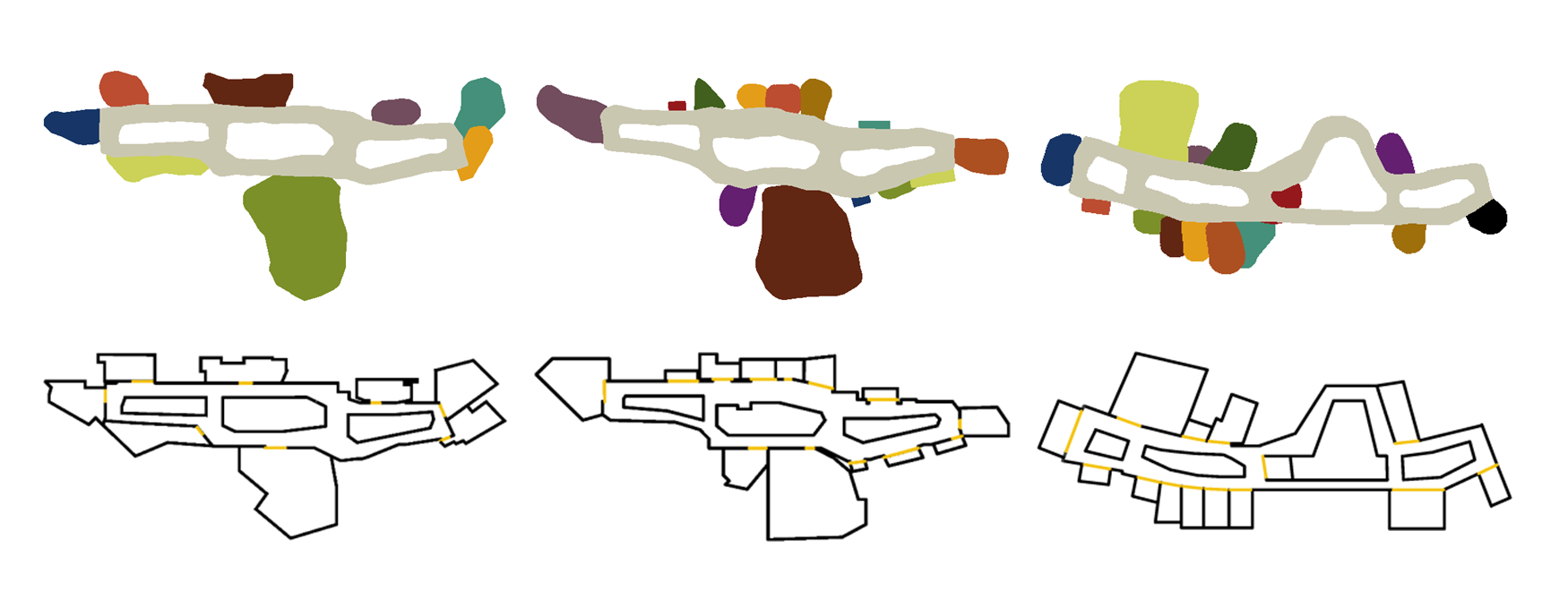
Reconstructed maps (top) and respective ground truth maps (bottom)